Thursday, December 17, 2015

ROLAND T. BIRD - Paleontologist


Unless you are a relative of Roland T. Bird you've probably never heard of him, but if you are interested in fossil tracks and dinosaur bones then you most certainly have.  For a man who never finished high school and suffered from poor health most of his life he achieved considerable success in the science of ichnology and as a paleontologist.  His work is displayed at several natural history museums in the United States including the American Museum Of Natural History in New York City.   

Roland Thaxter Bird was born in Rye, New York on December 29th, 1899.  His father was a successful businessman and distinguished amateur entomologist (insects).  His son Roland was forced to drop out of high school at age fourteen because of poor respiratory health, then his mother died of tuberculosis just one year later.  At the advice of the family doctor Roland was sent to live on his uncle's farm where he learned cattle husbandry, a trade that would serve him well later on in life. 

Roland was an adventurous and curious soul who wanted to travel so he saved his money and bought a 1929 Harley Davidson motorcycle.  He built a side-car camper onto the bike and with a like-minded friend, Theodore Schreiber, they headed to Florida.  In a letter to his uncle Harry, he described his travels throughout 1930 and 31.    

1929 Harley Davidson DL-45


[Sic] "We had hurricanes and near-hurricanes . . water . . more water . . and still more water.  I waded, an splashed, an swum around, for nearly two months of water.  About the time it got knee deep in the bed room , and instead of merely stepping out the door in water, one had to plunge into it, just to get outa bed.  Well, that wuz going a bit too far.  I had read of some deserts out west.  I sez to myself, It's deserts for me from now on . . just for a change.  I needed a change." 

So they rode their motorcycles to a steam ship and sailed off to Cuba.

They spent some months there exploring the country and the culture where you could buy most anything you didn't want, and hardly anything that you did. They also found the towns to be beautiful from a distance but filthy and unsanitary once you arrived.  At breakfast in a hotel one morning he found a cooked fly in his eggs and thereafter he only ate fresh bananas and pineapple for the rest of his stay.   

They returned to Florida just in time for the rainy season and were greeted by the arrival of the Great Depression.  Unfortunately, the bank in Florida where he had his money went bust.  So with just $150 dollars in his pocket and the rain at their heels they headed west.  $150 dollars in 1930 was worth about $2,500 today so he was pretty flush for awhile and he could live cheap.  He slept in his side-car camper and they cooked their meals over a camp-fire.  

R. T. Bird and friend V. Theodore Schreiber set up camp.

When they reached Texas they finally left the rain behind them.  At El Paso they swung down into Mexico for a ways; "an moseyed around - but the roads wuz rotten, an about every third person you'd see wuz a-bristling with weapons - a-lookin too much like bandits." They attended a bullfight but felt threated by the locals and crossed back into New Mexico.  

By the time they reached Phoenix, Arizona they were wishing for rain again for the heat was to much to endure.  It was too hot to ride, read or sleep and hurt to even breath.  Then a dust storm blew in just for variety and filled the food, bed and clothes with dust.  

Escaping Arizona at Yuma they found California wasn't much different until they crossed the Mohave Desert and reached the coast at San Diego.  They worked their way north into the Sierra Nevada Mountains through Sequoia and Yosemite National Parks.  They made it to San Francisco but with winter coming on it was too cold so they rode back down to Los Angeles.

Roland found his $150 dollars was getting rather thin so it was time to get a job.  Because of the depression jobs were scarce but he found one as a caddy at a golf course.  He liked it and it carried him through the winter and by spring he had saved enough to hit the road again.  Just then he received a letter offering him a job working as a cowboy for a wealthy cattleman showing his dairy cows at exhibits around the country.
      
NOTE:  Except for the letter to the uncle dates are questionable beyond here.  They are as close as I could I could determine or guess.

In 1932 he was camping in the desert near what would eventually become the Petrified Forest National Park where he found the skull of a giant fossil amphibian.  He strapped it to his motorcycle and drove it to Flagstaff, Arizona  where he bought some lumber and built  a box to  ship it to his father.   His father  in  turn  sent  the  fossil  to  Barnum  Brown,  a  famous  paleontologist  and  the  Curator  of  Vertebrae Paleontology at the  American Museum of Natural History (AMNH) in New York City. It turned out to be a new species.  This sequence of events would later lead to Rolands employment as Barnum Brown's right hand man in the field and a preparator of dinosaur tracks and bones at the museum. 

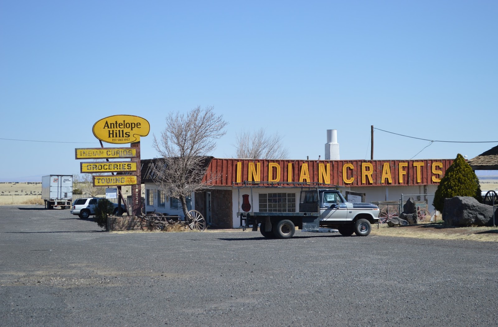
While in Flagstaff some locals told him about some giant bird-like dinosaur tracks near Cameron on the Painted Desert.  That night Roland went to a motel and while in the lobby he saw a pamphlet about the Cameron dinosaur tracks with a photo of Barnum Brown standing next to them.  The pamphlet said Brown had uncovered the tracks and they were in Dinosaur Canyon 16 miles east of Cameron.  The next day Roland rode to Cameron and stopped at the Indian trading post to inquire more about the tracks.  All he learned was that Brown had been there two years before but there was no road or trail to the site.   

The tracks had only been discovered in 1929 by Goldtooth Semahly, a Navajo shepherd while searching for lost sheep.  Barnum Brown somehow caught wind of it and since he was looking for tracks to include in an exhibit for the museum he hired the shepherd to guide him to the site.  Brown was looking for large sauropod tracks and wasn't interested in the bird-like theropod prints so he left. 

Now, three years later with only the photo on the pamphlet and  rudimentary directions, Bird took off cross-country to find the tracks.  For miles he negotiated the motorcycle and side car through washes and around cliffs until the engine overheated and he was blocked by impassable sand dunes.  In the distance he could see some rock features similar to what was in the photo so he grabbed a canteen of water and food and took off on foot.  By chance, good luck and tenacity Bird found the tracks late in the afternoon.  He studied them until dark and returned to his motorcycle with only starlight to see by.

I believe this to be a portrait of Roland taken in 1934 at the Cameron track site.

However, in his manuscript he mentions finding the site in 1932
but not returning to the vicinity until 1937 with Barnum Brown.

For a lack of supplies he headed back to Cameron.  Finding the amphibian fossil skull and the Cameron track site sparked a passion within him that would become his life's work.  Over the next decade Roland scoured the country searching out dinosaur bones and track sites from Arizona, New Mexico, Colorado and Utah to Wyoming and east to Connecticut and New Jersey.

During that time he worked at the Howe Quarry in Wyoming, a massive sauropod boneyard, where he drew one of the most complex paleontological charts ever produced.  It is a work of art in its own right.  Starting in 1934 Roland spent many years as an employee of the AMNH and as Brown's right-hand man in the field.  During WWII he was contracted by the government to find uranium deposits in the Four-Corners region.

Roland's Howe Quarry Chart


Roland T. Bird (far left standing)
Barnum Brown (front row center)

His crowning achievement was the discovery, collection, and interpretation of the gigantic dinosaur trackways along the Paluxy River near Glen Rose and at Bandera, Texas in 1940. A track sequence from Glen Rose is on exhibit at the AMNH and at the Texas Memorial Museum in Austin. His interpretation of these trackways demonstrated that a large meat eating carnosaur had pursued and attacked a sauropod, that sauropods migrated in herds and they could support their own weight out of deep water. These behavioral interpretations were contrary to then-current beliefs and not fully accepted for at least two decades.

Paluxy River trackway - Glen Rose, Texas


Roland had to retire early for health reasons and wrote the manuscript for his book, "Bones for Barnum Brown: Adventures of a Dinosaur Hunter", edited by V. Theodore Schreiber and posthumously published in 1985.  Roland T. Bird passed away on Jan 24, 1978.

*     *     *

In 2001 I drove through the Petrified Forest National Park and stopped at the visitor's center and museum.  While there I purchased a book about the Painted Desert and in it was an account of Roland T. Bird's search for the Cameron dinosaur track site.  I was so impressed and inspired by his adventure that I decided I would someday search for the tracks myself.  Since I lived in Flagstaff, only 60 miles from Cameron, it seemed a very plausible idea but there were a few obstacle's I would have to overcome first. 

To be continued in the following post 'The Cameron Dinosaur Tracks' about my search for the track site.

Mark t.

Wednesday, November 25, 2015

THE SLIDE FIRE GHOST TREES


The Slide Fire started just north of Slide Rock on May 20, 2014. Before it was contained sixteen days later it had consumed over 21,000 acres. A quarter of Oak Creek Canyon and parts of West Fork, East Pocket, Harding Point, Sterling Canyon and Howard Pocket had also burned.

For decades I had hiked and explored these places and I cried as I watched them being devoured by fire on the nightly news.  I understand that ground fire is important to keep a forest healthy,  but this fire had crowned and killed millions of trees.  It would not recover in my lifetime.

Two weeks after the Slide Fire I drove through the blackened forest. Most of the ground cover was gone, not a pine cone, blade of grass, fern or low branch remained. The forest floor had been swept clean. I found that the burn was worse than I had hoped but not as bad as I feared. At least in this area the fire had stayed on the ground and not crowned into the tops of the trees like many areas.

East Pocket

As I walked around the blacked tree trunks I found many large deep holes in the ground. They looked like giant footprints that some monstrously heavy dinosaur had left behind as it stomped through the forest. Some of there were nearly three feet deep. At first I thought they were animal burrows exposed when the forest detritus had burned away but there were too many, and they were too big. Then I thought maybe they had been dug by the fire-fighters but there weren't any piles of dirt or rocks scattered about. Then it dawned on me that they were burned out tree stumps.


Thousands of dead and dry stumps had been left behind after the old growth trees had been cut and dragged away by mule trains and railroad over a century ago.  Now with the brush and forest detritus burned away they became  even more noticeable by the voids they left.


I continued walking and came to the edge of a ravine and tributary to West Fork. There the fire had been much worse. Because of the steep slope the limbs had reached closer to the ground and the fire had climbed up the branches like a ladder and completely torched the trees.

I scaled down the ravine to the bottom. There the ash was ankle deep and rose in clouds as a shuffled along. Even after the fire had been out two weeks I could feel heat rising from the ground through the soles of my boots.

 Into the ravine.
  
I came to another stump hole but at this one I could see the ghostly image of the tree that had fallen next to it.  There wasn't any ash on the ground where the tree trunk had fallen and burned.  The white limestone soil was bare but had areas where it had turned pink from being baked by the intense heat. It was an eerie sight.  I think winds and updrafts created by the intensely hot fires is what removed the ashes from the stump holes and logs. 

The ghost tree.

Not even ash remained of the stump, trunk or limbs. 
I left the ravine and drove on to the end of the road where I found this sign, "E Pocket Lookout." It was half melted and the letters distorted like some 1960's psychedelic poster.  I was surprised, I didn't realize the sign was a plastic stencil.  I always thought those letters were painted on. 


I walked up to the road to the fire lookout tower to see if it had survived the blaze and it had. The attendant came down and admonished me for being in a closed area. He told me he remained there during the fire and how hard the fire-fighters had worked to save the tower.  It sounded like quite the scary ordeal.
East Pocket Lookout Tower

Four years after the fire I drove out to Harding Point.  It used to take about an hour to get there from highway 89A on Forest Service Road 535.  I took a chainsaw with me in case trees had fallen across the road.  Dozens had and it took me three hours to clear the road and drive there.  Thousands of dead black trees still stood and the ground had been taken over with tall, coarse grass and thorny brush.  It was ugly.   

Thursday, November 19, 2015

SINKHOLES


A veneer of volcanoes and lava flows, known to geologists as the San Francisco Volcanic Field, cover an area fifty miles long and thirty miles wide around Flagstaff. Underneath all of it is a layer of limestone where sinkholes and caverns tend to form.


Orchid Paper

When I moved to Flagstaff in 1979 I found a job as a mechanic at Orchid Paper on Butler Avenue.  It is the same property where SCA Tissue is now.   At that time, next to the steam boiler in the manufacturing plant, was a drain pipe that dumped hot waste water down a natural opening in the ground twenty-four hours a day, seven days a week.  In the machine shop next door, there was an unnatural hole in the poured concrete floor where a six foot section of it had collapsed three feet into the earth.  There were orange cones around the hole to keep workers from walking into it.  In the four years I worked there it was never filled in, but I hope SCA would have repaired it and stopped dumping waste water into the ground when they took the business over.


Citadel Sinkhole

The Citadel Sinkhole is the largest sinkhole in the San Francisco Volcanic Field at 600 feet long, 350 feet wide and 170 feet deep.  Located inside the perimeter of Wupatki National Monument, hiking is not permitted into or around the sinkhole.  There is a trail to the Citadel Indian Pueblo which overlooks the massive pit.  


The sinkhole from the Citadel Pueblo looking south toward the San Francisco Peaks.
A cavern formed in the Kaibab Limestone at the very edge of an old lava flow.  The lava flow is the gray rock layer on top, the limestone is the white and red banded cliff below it.  For the floor of the sinkhole to be 170 feet deep, the limestone cavern had to have been at least that tall.  

Looking north toward the Citadel.

I wanted to walk to the Citadel overlook but a sign said no dogs allowed.  I wanted to walk my border collie so I drove a half mile further down the road and pulled to the shoulder and walked across cinders to this location.  When I returned to my vehicle park rangers were waiting for me.  They told me no cross country travel was allowed anywhere in the park.  They were very nice and only issued me a warning. 

Arrowhead Sinkhole

The Arrowhead Sinkhole is just outside the boundry line of Wupatki National Monument, so it is legal to drive to it and to hike there.  On the south side of the Antelope Hills Trading Post follow the dirt road next to the fence line heading east.  The is one short, rocky section you need a high clearance vehicle.  Follow the fence for three miles to the end of the road at the foot of a lava flow.  The sinkhole is on top of the hill.    


 Follow this road next to the Wupatki National Mounument boundry fence.

Hummm, which road to take?

After the rough section turn left on this road.

 The parking area at the bottom of the hill.

A short walk up the hill is Arrowhead Sink.

  
I found this sinkhole while exploring on Google Earth.

This sinkhole is 500 feet long by 150 feet wide and 130 feet deep.  Like Citadel Sinkhole this one also formed at the edge of a thick lava flow.  Neither lava flow had poured into the holes so the cavities in the limestone formed after the flows were in place and the roofs collapsed later.


The stratigraphy at the Arrowhead Sinkhole is typical of most of the San Francisco Volcanic Field.  This particular lava flow is about 80 feet thick but the lava gets thicker as you head west to the volcanic field around Williams. 

 For scale find the hiker standing at the bottom of the cliff.

South of Flagstaff the sinks are more numerous but smaller and some hold water in wet years.  There are also many stock tanks.  You can differentiate stock tanks from sinkholes by an earthen berm that encircles the tanks on the downhill side.   

Most of the sinks are found in areas were the limestone hasn't been covered by lava flows.  This suggests to me there are many more of them out there hidden from view underneath the patina of lava.  The lava is highly fractured by shrinkage cracks that formed as it cooled from a molten state, thus rain can easily find a way through it down to the limestone below.  Rain being acidic, particularly in our industrial society, dissolves the limestone.  To our advantage Arizona is an arid state and cavities from slowly.        

 Sinks

There are several shallow, dry sinks scattered throughout the forest southeast of Mountainaire.  They are mostly found in the grassy areas called 'parks' where trees don't seem to grow.  Maybe they are too soggy during the wet seasons.  There are also several sinks that hold water.


Saginaw Sink

Saginaw Sink is small and has clean water in it most of the time.  I have found it empty in the driest years.  It is located .4 miles southwest of the Flagstaff community of Mountainaire.

Quarry Sink

Quarry Sink has water in it during the winter and spring but dries up during the summer months.  It is located 300 feet east of Highway 89A, 1.9 miles south of the entrance to the Forest Highlands gated community.  It is hidden by pine trees and not easily seen from the highway.  You must crawl under a barbed wire fence to get to it.

 Crusher Sink.

Crusher Sink.

Crusher Sink is also near Highway 89A.  It is well hidden up the side of a hill overlooking an ugly, abandoned gravel mine.  It's 150 feet wide and always has water in it.  It's one of my favorite places to go to photograph dragonfly's and just relax.


Anderson Mesa Sinks

Anderson Mesa southeast of Flagstaff is a limestone horst bounded on the south side by the Anderson Mesa Fault and Lake Mary which lies in a graben.


There are many small lakes and ponds on top of the mesa that are being charged by water seeping through subterranean channels from Mt Elden and the San Francisco Peaks.  I believe most of these if not all are shallow sinks.  This would include Marshall Lake, Vail Lake, Deep Lake, Ashurst Lake and a dozen more smaller ones.

Anderson Mesa


Thursday, November 5, 2015

IN MEMORY OF DAN DICKEY


Daniel Dickey in 1980

The first time I met Dan was at  a swimming hole in Sedona called the Point in the summer of 1967. His family had moved from Fort Worth, Texas and bought a creek side property to open a tourist resort called Brookhaven.  It was just a hundred yards upstream from the Point.  We quickly became friends that summer swimming in Oak Creek and hiking the mountains around Sedona.  Dan taught me about hunting and I showed him how to do trick dives off the rope swing at the Point. When it was too cold to swim we spent hours at his house playing Spades and Cribbage.

Dan had a Texas drawl that I found interesting.  He loved football and the Dallas Cowboys.  He lifted weights in the basement of his house and stayed fit to play football for The Eagles at Flagstaff High School.  At school we didn't see much of each other, we didn't have any classes together and he stayed after school for football practice so we hung out with different crowds.

We both graduated from high school in the spring of 1970.  Dan found a job learning carpentry and I started working as a landscaper until 1971.  Then, to avoid the army draft we both went to Northern Arizona University as roommates.  We had little interest in school and partied too much and left after just one semester.  Dan stayed in the area and I wandered off to Detroit, Michigan where I worked in an automobile factory. Dan once showed up unexpectedly in Detroit to visit.  He drove all the way from Arizona in an old Ford pick-up truck with a wooden camper he had built on the back, complete with an asphalt shingled roof.

When I returned to Phoenix in 1975 Dan was still in the Sedona area.  The following year he and I lived in Jerome house-sitting for a friend that had gone traveling.  The house only had cold running water and an ancient wood cook stove.  If you needed to wash up there was a garden hose outside nailed to a wooden  post inside a bamboo stall.  We worked just enough to buy food and spent most of our days swimming in the Verde River and hiking around the Verde Valley.  In the fall I left to go backpacking in the Sierra's.

When I returned from California I moved to Phoenix.  At the time Dan was living in an old cabin on Oak Creek near the mouth of West Fork.  The front door was a hollowed out tree trunk cut in half length-wise and hug on hinges.  One interior wall was a giant basalt boulder.  It was a unique place and should have been saved as a historical structure, but it was torn down and replaced by a modern condo years later.

The log cabin on Oak Creek near the mouth of West Fork Canyon - 1977

Overlooking West Fork Canyon - 1977

By this time Dan was driving a red 1 ton flatbed truck with wooden side rails around the bed.  He told me a story how he had picked up an attractive woman hitchhiking on I-40 one time.  It turned out she was a dancer/stripper traveling from Las Vegas to Phoenix.  After some conversation in the cab she had climbed into the truck bed and danced her routine while Dan drove down the freeway back to Flagstaff.

In 1978 Dan moved to Mesa and worked as a carpenter setting concrete forms at the Palo Verde Nuclear Power Plant.  We would get together sporadically and go hiking and backpacking in Arizona and Colorado over the next several years.
   
The last time I saw him was the winter of 1984 when we cross-country skied into Locket Meadow at the San Francisco Mountians.  After that Dan moved to California and went to work for a contractor building apartments.  I spoke to him on the phone for the last time in 1990 then we lost track of each other.

In January of 2014 I was looking through some old slide photos and came across many of Dan taken during our adventures together.  I decided to look him up on the computer and I found an address for his parents living in Cottonwood.  I wrote a letter which was answered a month later by Dan's sister Cheryl.  She told me their parents Bruce and Juanita had both passed away years ago, and Dan had died on January 13th, 2012 in Cottonwood.

Dan was a kind and peaceful soul with an easy smile and a big laugh.  He was always willing to try what was difficult and he had no fear of heights.  He told me several times during his life that he was born a century to late.  He was serious about that and  I believed him.  He loved to read books about mountain men and cowboys and enjoyed movie westerns the most.

Rest in Peace 

Daniel Dickey
born 1951
died 1/13/2012


These photos are a record of some of the adventures we had, the miles we hiked and the mountains we climbed.  He was my friend and I have missed him.


The Inner Basin Ridge at the San Francisco Peaks - 1977


 On top of Humphreys Peak of the San Francisco Peaks - 1977

 
  Wing Mountain northwest of Flagstaff - 1977


 The Superstition Mountains - 1978 


 Reading a book in the Superstition Mountains - 1978


Emerald Lake, Weminuche Wilderness, Colorado - 1980


Free climbing - 1980


The San Juan Mountains -1980


 Camp at Rock Lake, altitude 11,900 feet - 1980


Box Canyon, Ouray, Colorado - 1980 


We cross-country skied into Locket Meadow, San Francisco Peaks - 1984
 There were many other hikes and adventures for which no photos exist.


I am a musician so in 2002 I wrote and recorded a song about Dan.
He loved the harmonica so I incorporated a harmonica into the song.   
It is available on Spotify, Apple Music, Amazon Music and YouTube music servers.


LAST LONG ROAD
© 2002
by Mark  Thomas

Sometimes you have a bad day
 when you don’t see no way
you can make it alone.

Days long, hard and rough.  
Just getting by is real tough
when there is no place that feels like home.

Can’t find a job and your spirits low.  
The woman you lost seems so long ago
far to restless to ever settle down.

Trucks broke down and your busted flat.  
Got no clue where the hell you’re at
on that highway out of town.

I can see from the lines in your face
 that everything and dream you chase is
always just a few more miles.

Stick out your thumb.  Get yourself a ride.  
Come and see me anytime.
Kick off your boots and stay a while.

I don’t have an answer which way to go.  
Won’t even pretend to know.
Might just ask for help from up above.

Hit your knees boy and start to pray.
   “Lord!  Help me through another day.”
Carry me down this last long road.


8-30-2016
Last week I had a dream about Dan:  My wife and I were standing in the front yard of our house.  An old primer gray pickup truck stopped on the street and Dan and a woman got out.  As they walked up to me Dan introduced the woman as his wife.  He and I said hello and we embraced then the dream ended.  I believe the dream was about my wish for him.

2-17-2018
Another dream of Dan:  He drove up to me in a blue super sports car and stopped.  He got out for a moment then got back in and tried to start the car but it wouldn't crank over.  I went over to look at it and found linkage attached to the door that if the door wasn't closed completely the car wouldn't start as a safety precaution.  I closed the door and Dan started the car and drove off.  A few minutes later he drove up again but this time he was driving some sort of yellow dune buggy.  He stopped but just sat there in the car looking very sad.  We didn't speak at all.


Thursday, October 22, 2015

BLACK CANYON - Arizona's Beach Front Property


This photo/essay is for those with at least a basic understanding of structural geological.

The Sunset Point Rest Area on Interstate Highway I-17 sits on the precipice of a thick lava flow overlooking Black Canyon Basin to the west.  Today it's a nice view of the basin and the Bradshaw Mountains but 1.75 billion years ago it was a very different place.  You would have been standing on the west coast of the North American Continent looking at the Paleo-Pacific Ocean.  Yes!  Arizona had beach front property and a seaside view long before the pieces and parts that make up California ever collided with North America.

The northern end of Black Canyon Basin. 

You are looking at a convergent zone where the Paleo-Pacific Plate was being subducted beneath the North American Plate.  Seamounts and islands were sheared off as the oceanic plate ground beneath the continent crust and were added as land to the edge of the continent.  Although it happens slowly it is a common occurrence at convergent zones and is how continents add land mass and grow wider.

However, the Black Canyon Basin is somewhat different.  What you can't see from the rest area is that the floor of the basin is an ophioltic sequence.  You ask, "What is that?" Simply put an ophiolitic sequence or suite is the vertical sequence of rock that makes up oceanic crust, but this raises a another question?  What is oceanic crust doing in the center of Arizona?   

 
Ophiolitic Suite

To understand how a desert valley in central Arizona had beach front property let's review some basic plate tectonics.

The floor of the ocean is created as magma extrudes from the earth's mantle along a crack at the bottom of the ocean.  The crack is actually a valley (the mid-ocean ridge) at the crest of a very long mountain range.  There is such a mountain and valley called the Mid-ocean Ridge that was discovered and mapped by the US Navy during the Cold War.  It is 40,000 miles long and encircles the earth through all of the ocean basins.  

The sides of the ridge move apart for three possible reasons: First, and least likely, the pressure of volcanic eruption forces the valley to widen.  Second, the magma chamber creates a bulge above it and gravity slides the opposing sides of the ridge down the slope from each other in a slow motion avalanche thus widening the valley.  Third, and most probable, the convection current in the molten rock under the solidified crust drags both sides away from each other like an endless conveyor.

As oceanic crust is created at a spreading ridge, an equal amount of mass must be subducted back into the mantle somewhere else on earth.  This occurs because oceanic crust is made up of denser rock than the continents on which we live, so when the two collide the ocean floor grinds its way underneath the lighter continental land mass.  However, when a bump (such as a mountain, island or spreading ridge) encounters the continental land mass it can be sheered off to become part of the continent.

Nearly two billion years ago Arizona was the western edge of the North American Continent.  The Falleron Oceanic Plate (now long gone) was subducting under Arizona at the time.  When its spreading ridge collided with Arizona it sheered off and became part of the continent.  Its metamorphic remains, laden with valuable metals and minerals, is now the floor of the Black Canyon Basin.

There are two exits off of I-17 to get down to Black Canyon Basin, the Bumble Bee exit 248 and Bloody Basin exit 259 to the community of Crown King in the Bradshaw Mountains.  It is a hot desert environment in the summer and not the place you want to be, but in July and August the seasonal monsoon rains rumble through Arizona and saturate the land with water.  Usually dry washes start to flow and the cactus swell with moisture.  By mid-fall it cools off and that is the  best time go exploring there.  It's generally a good dirt road but if you venture into Black Canyon itself a serious high clearance 4WD vehicle is a must.  I use a quad.  Be aware of possible flash flooding, impassable washes, wash-outs and rock falls.

The drive from the Bloody Basin exit is the better to view the geology.  The ophiolitic sequence is sandwiched between a granite batholith on the east on which I-17 rides and the Bradshaw Mountains on the west, also a granite batholith.  Both these granite plutons intruded after the ophiolite was in place.  I expected to find rocks in a specific order: horizontal sediments, limestone, pillow lava, vertical sheeted dykes, gabbro, and peridotite.   Moving away from the granite I came to vertically layered slate and shale.  This baffled me at first then I realized the ophiolitic block had rolled 90 degrees when it was sheered off of the oceanic plate.

There are numerous ridges of sedimentary rock down in the basin. 
Sedimentary rock next to the granite was metamorphosed into black slate.

A slate seam.

Further away from the granite where it wasn't as hot are beds of shale.


The layers are only a few millimeters thick.
Colorful green and yellow lichen grows liberally on the red shale.
Saguaro Cactus grow out of a bed of limestone chert deposited by deep ocean.
Valuable minerals were deposited by super-heated water and magma.  There are many abandoned mine shafts (vertical) and drifts (horizontal) throughout the basin and in the Bradshaw Mountains. Some are still active and being worked.  Be careful not to drive into a mine shaft.  I found some that were open and unmarked next to roads.
  
 This abandoned shaft is right next to the road.
The Golden Turkey Mine office.
It was a residence up into the 1980's and burned in 2006.

The Golden Turkey tailings pile.

An explosives bunker was located well away from the Golden Turkey Mine.
This one speaks for itself.  Everything about it looked dangerous and I didn't go near it.

The tiny town of Cleator on the road up to Crown King. 
Just past the town is the road down into Black Canyon.
  
The St. Johns Mine

Prickly Pear cactus and a lava dike protrude through the shale.


Prickly Pear cactus grow a purple fruit that can be made into jam. 
It requires a federal permit to harvest the "pears".

Sheet dikes in Black Canyon.

The entrance of a flooded mine.

 Turkey Creek in the bottom of Black Canyon.
An abandoned bicycle at an abandoned cabin.  The bicycle is no longer there.

The Spire.

Saguaro cactus next to the road through Black Canyon. 

A Crested Saguaro is a genetic mutation that affects only 1 in 200,000 saguaro cactus.   


The Howard Copper Mine
A rough section of road cuts through a layer of metamorphic schist. 
The greenish tint of the rock is caused by the olivine mineral.  

 Out of the metamorphic depths of Black Canyon and back to the granite of Bumble Bee Creek.

In the Black Canyon Basin shale and slate, limestone and marble can be found in thick layers.  Since they sit vertically the ophiolitic sequence had to have been rotated 90 degrees.  So, what seem to be vertical lava dikes in the canyon must actually be volcanic sills.  The dikes and pillow lava's must still be buried, missing, or I haven't found them yet.  

I've been looking for pillow lava on the west side of the basin closer to the Bradshaw Mountains but I'm finding sills there.  The sedimentary layers of shale and limestone are further east.  Then it occurred to me it makes a difference which direction the ophiolitic suite rotated.  If it turned clockwise (to the east) this makes sense;  vertical sills to the west and vertical shale to the east. Unfortunately the dikes with the pillows on top may have been consumed by the granite batholith that intruded after the ophiolite was scraped off the oceanic plate.  What dikes and pillow lavas remain they would be on a horizontal plane and either eroded. consumed by granite, or still buried possibly under the thick lava flow on the east side of the basin.  

In fact there is an exposure of pillow lava just a mile away. A road cut on I-17 north bound at mile marker 249 exposed some pillow lavas.  I don't believe they are part of the ophiolitic sequence.  A granite batholith separate the two so it isn't likely.  The pillows are very eroded and not well defined.


 Road cut on north bound I-17 at mile post marker 249.

The exposure is very old and eroded but still shows the bulb like texture typical of pillow lavas.