Wednesday, January 12, 2022

VOLCANIC NECKS


COLORADO

The first time I drove to Pueblo, Colorado I noticed a black-rock hill sticking up out of the prairie that looked very out-of-place.  It was about 35 miles south of Pueblo on the east side of the I-25 freeway.  Some time later on one of my exploratory excursions I found a dirt road that went by it.  Once I got closer to it I recognized it for what I suspected it was, a volcanic neck. 

Huerfano Butte


A volcanic neck, or plug, is the subterranean pipe that once fed an ancient volcano.  It is the cold, hardened core exposed after the original volcano and surrounding sedimentary rock has eroded away over many millions of years.  Being more resistant to erosion the igneous rock remains as the last one standing. 

Huerfano Butte is 150 feet tall.


Over the eons Huerfano Butte has crumbled away into a blocky scree slope but a solid core still remains at the center of the pile.  


Huerfano Butte Thinking Rock


As I sat on one of the larger basalt blocks that had tumbled down the slope I started thinking about all the volcanic necks I had seen in Arizona and other western states.  There are quite a few ranging from Wyoming, to New Mexico. and Colorado.  Most are  hardly noticed and others are famous and one even became a national monument.


WYOMING

In the summer 1978 I traveled up to Wyoming with friends to visit the three national parks and monuments there: The Grand Tetons, Yellowstone and Devils Tower.  Devil's Tower National Monument is in the northeast corner of the state.  It had recently been made famous by the 1977 movie, Close Encounters of the Third Kind by Steven Spielberg.  


Devils Tower is about 40 million years old and 1,253 feet tall.
(internet image)
 
This was my first encounter with a volcanic neck although this one looks much better than most.  It appears better preserved and is certainly the most impressive.  There are several hypothesis as to how it formed and I lean towards the one that it was a molten lava lake inside a larger volcano.  I consider two characteristics  that support this idea; the flat top and the columnar jointing.  A flat top would be indicative of a fluid lake and the columnar joints are long crystals that can only form, or grow, if the lave cools very slowly and remains undisturbed.  A surrounding volcanic mass and earthen pipe would  insulate the lava  from cooling quickly and a recently dormant magma plume below would continue to cook the pool for decades or centuries to come allowing time for the crystals to form.     


Devils Tower columnar jointing.
(internet image)
I also believe the long, vertical crystals add strength to the structure like the stanchions in a skyscraper.  The crystals certainly contribute to the necks pristine condition and longevity.  If it didn't look so good would they have made it a National Monument?  
      

 ARIZONA

In the southern part of Arizona southeast of Phoenix and east of the town of  Apache Junction is an extinct volcano called the Superstition Mountains.  It is famous for the legend of the Lost Dutchman gold mine which was "lost" in the 1870's somewhere in the rough dessert terrain of those mountains. There were many books,  movies and a TV series made about it as any story of buried treasure always does.  

Superstition Mountains
(internet image)

Supposedly the mine is in the vicinity of a landmark known as Weaver's Needle behind the mountain.  As the name suggests, Weaver's Needle is a volcanic neck.  At least that is what it appears to be. However, there is not sufficient geologic evidence to support the theory it is.  It could be just an erosional anomaly according to one geologic study I read.  If it coincides with the original eruption of the Superstition Mountain it could be 29 million years old.  I could not fine a date assigned to the needle itself.  

Unfortunately, you can't drive to the needle or get to a location where you can get a close up view  unless you hike 1,300 feet up a challenging foot path to a ridge called Fremont Saddle.  This should not be attempted in the summer but is a pleasant hike in the winter.  I did it in 1976 and remember it as an "ankle breaker" because of the loose, round rocks that peppered the trail.  Maybe it is better now.  It is only 1,000 feet tall but looks to be much more because of the base it sits on, just like the Statue of Liberty on the pedestal in New York Harbor.  Apparently it is a class 5.0 climb to the top of the needle but a long arduous walk to get there and suggested for advanced climbers only.   

Weaver's Needle as seen from Fremont Saddle 
(internet image)

The small city of Prescott in central Arizona was established at the foot of a volcanic neck.  It served well as a landmark for early settlers to help find the place.  There seems to be some debate whether Thumb Butte is a volcanic neck or a dome, a thick lava flow that extruded from the volcano below it.  It erupted about 12 million years ago so it isn't that old which may contribute to the idea it isn't a neck.  In the geologic time scale that isn't a lot of time for the necessary erosion to take place.  The majority of what I have read consider it to be a neck so I'll run with that.  


Thumb Buttes proximity to Prescott make it a popular hike. 
It is 1,500 foot tall including the base.
(Internet image)


THE NAVAJO VOLCANIC FIELD

ARIZONA, NEW MEXICO, UTAH, COLORADO

In an area encompassing 20,000 square miles of the Four Corners states is the Navajo Volcanic Field. 25 to 30 million years ago a hot spot lay beneath this area and was the source of magma for over 80 volcanic vents. 


Navajo Volcanic Field


In the map above a distinction is made between tuff pipes and diatremes.  Tuff pipes form the typical cinder cones and lava flows that pile up around vents. Tuff being the new strata that may be formed if the ejected material is hot enough to weld itself back together when it hits the ground.  .   

How a tuff pipe neck would form.


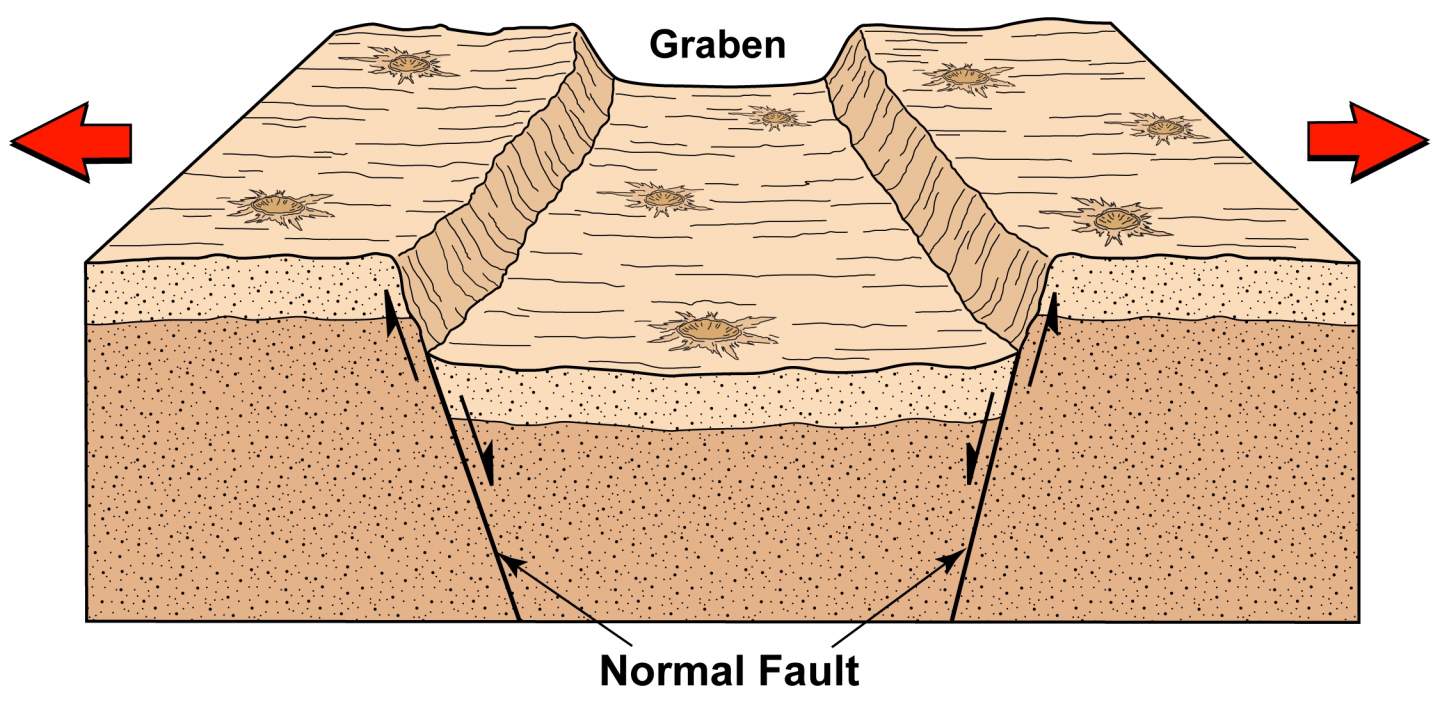
A diatreme is a violently  explosive eruption, often associated with water or high velocity gas (kimberlite) that blasted the earth away leaving a depression in the ground and a tephra ring around the pit.  With enough erosion either type can form a volcanic neck but the diatreme would have  been  deeper underground.  It may take an analysis of the rock chemistry to identify a kimberlite type magma which originates in the asthenosphere.  It would contain a higher concentration of the mineral olivine.     


The Four Corners region is home to the Navajo Indian Nation and the volcanic outcrops there are sacred to the tribe and part of creation stories.  The locals do not appreciate non-natives on their land  so stay on the paved or dirt roads and do not approach the volcanic features on foot.   All of my photos are taken from the road. I travel between Colorado and Arizona once or twice a year and it is my habit to take a different route as much as possible. Doing this I have passed through some beautiful country and passed many of the renowned volcanic necks.  

Starting in the northwest portion of the Navajo Volcanic Field we are going to visit some of the more notable volcanic features.  First is Alhambra Rock in Utah. Heading south from the community of Mexican Hat on highway US-163 you can see it just one mile to the west of the road.  Most necks are basically round like a pipe but this one is long and narrow.  It is not very tall, just 250 feet and appears to be a part of a longer dike orientating north/south.  Dikes are earth cracks radiating out from a volcano forced open by the pressure of the rising magma.  Alhambra Rock appears to be the epicenter of a dike and probably produced a fissure eruption.  

Alhambra Rock

Continuing south on US-163 through Monument Valley and thirty-three miles towards Kayenta is Agathla Peak.  This is one of  the larger volcanic necks jutting up from the desert floor and can be seen from a long ways off.  Rising over 1,500 feet it is the remnants of diatreme eruption.  

Agathla Peak diatreme 1500 feet tall


Most of the volcanic necks are thought to be monogenetic, meaning derived from a singe eruptive event.  This is not true of Agathla Peak. There is a dirt road that passes closer to the back side of peak.  In the morning light it is obvious a second eruption took place sometime after the first one had cooled.  


Agathla Peaks secondary eruption vent.


The arrows point to an inner pipe with a darker color and a blocky texture that forced it way through the first plug.  This suggests to me that the chemistry of the magma chamber had changed and it was at a lower temperature than the first eruption. 

Chaistla Butte 400 feet tall.
(internet image)


Chaistla Butte can be seen just 3 miles south of Agathla Peak.  It erupted as a diatreme some 30 million years ago.  . 


From Chaistla Butte go south to the community of Kayenta and head east on highway US-160.  In 7 miles Church Rock is north of the road.  Like Alhambra Rock, Church Rock  it is long and narrow and is the feeder dike to the volcano that was once above it.  

Church Rock diatreme.


Church Rock is named for the 400 foot tall steeple like tower at one end, 
There must have been an aquafer in the area that caused Agathla, Chaistla and Church Rock to all be diatreme type volcanoes.


Part of the dike is buried in the wind blown sand. 
(Google Earth image)

Leaving the western end of the Navajo Volcanic Field we travel 70 miles east into New Mexico.  To get there I took a backroad Indian Reservation Route 13 through the Chuska Mountains.  At one point the trees opened up I could see this view into New Mexico.   

Mitten Rock & Shiprock from the Chuska Mountains.


Black Rock
(internet image)
As the road descends out of the mountains it turns north towards Black Rock still in Arizona.  It's an impressive site where it protrudes out of the red sandstone cliffs.  I couldn't find any information about it specifically but there it is.  


Mitten Rock
(Internet image)

Route 13 crosses over the New Mexico state line and past The Mitten on the north side of the highway.  It is another diatreme over 800 feet tall and the epicenter of a fracture zone.  It is sometimes referred to as Little Shiprock.   

Shiprock, eight miles to the east is the the largest, tallest and most impressive of the volcanic necks.  Also a diatreme it went through multiple eruptions 27 million years ago.   

Shiprock (Rock with Wings)
(internet image)


The Navajo Rock With Wings.  If viewed by satellite three prominent dikes can be seen radiating out from Shiprock which look like wings.  Route 13 passes through the largest of the three.
 
Google Earth satellite image


Shiprock dike 1
Shiprock in the distance


South of Shiprock about 20 miles, highway US-491 passes between a pair of volcanic necks just 1.5 miles apart.  In this photo heading north Bennett Peak is on the left and Ford Butte on the right. 

Bennett Peak (left)                                                         Ford Butte (right) 


Bennett Peak 870 feet tall


Ford Butte 550 feet tall


The Chacoan civilization lived in this area between 800 - 1,100 AD, and this group of three volcanos: Shiprock, Bennett Peak and Ford Butte, were a part of their sacred beliefs.  The Navajo arrived 200 years later and then they embraced similar beliefs about the volcanos. 

There are many more than the volcanic vent I just mentioned but these are some of the more notable ones and the ones most likely you are to come across.


COLORADO

Leaving the Navajo Volcanic Field and back in Colorado is the Spanish Peaks Volcanic Field.  It is in the south-central part of the state 60 miles south of Pueblo.  One would think it to be part of the Rocky Mountains but it is actually a mush later later event.  24 million years ago an igneous pluton rose and became the source of magma for the Spanish Peaks.  There are three volcanic necks associated with that magma plume.

Goemmer Butte rises 530 feet above the surrounding terrain.


Goemmer Butte is at the base of the peaks to the north near the small town of La Veta.  


Gardner Butte, 350 feet from base to top.


Twenty-two miles further north in the Huerfano River Valley is the Gardener Butte outside the town of the same name.


Now finally back to Huerfano Butte in the plains east of I-25 where I started this journey.  


Wednesday, December 29, 2021

FROM ARIZONA TO COLORADO

After living in Northern Arizona since 1956,  I have moved and bought a house in Pueblo, Colorado.  It is located in the transition zone between the Great Plains and the Rocky Mountains.  If I look to the east I can watch the sun rise over the flat, grass lands that stretch 800 hundred miles to the Mississippi River.  


The Great Plains


Then I can turn around to the west and watch the sun set over 
Lake Pueblo and the Rocky Mountains thirty miles distant.

Lake Pueblo and the distant Rocky Mountains.

Starting with this post on I will leave Arizona and start to explore and research the geology of southeastern Colorado and the southern Rocky Mountains.  Although very different I will be making comparisons between the geology of Arizona and Colorado.  There is much to learn and new lands to explore.  ROCK ON!


Friday, August 21, 2020

THE DARTON DOME ENIGMA


Several years ago I was working on a story about Strawberry Crater.  I had already explored the dead volcano and had taken a number of photos but I had not captured one that showed the entire cinder cone from a distance.  The problem had been the tall Ponderosa Pine trees that obstructed views around it.  

Later on at home I used Google Earth to locate a minor, unnamed volcano off of Forest Service Road 546 that I thought might offer a clear view of the cinder cone.  In February of 2015 I drove from Flagstaff and found the small volcano and hiked up to its rim.  I was not disappointed, from the top I had a clear view of Strawberry Crater two miles to the north-east.


Strawberry Crater


I took the photos I wanted then stopped to look around from my vantage point above the trees.  O'Leary Peak was two miles to the south-west with Darton Dome next to it.  I was slightly familiar with O'Leary, I had climbed it and the fire-tower at its top nearly 40 years ago.  I didn't remember anything unusual about it at that time but now, from this direction, it looked very different.  O'Leary Peak wasn't just next to Darton Dome but looked like it was inside of it.  


The Darton Dome / O'Leary sandwich.


I had seen O'Leary Peak many times over the decades from Sunset Crater Volcano National Monument to the south and east but never from the north.  From here it appeared as if O' Leary had bisected Darton Dome and shoved the two halves apart as it extruded up between the dome.  

Technically Darton Dome only refers to the hill on the left, O'Leary Peak is the tallest one in the middle and an unnamed dome is on the right I'll call Dome B.  When viewing O'Leary from the south or east Dome B is hidden from view.  


Because of the cliff faces on both domes it appears they were once joined together. 


Below is another photo of the cliff face on Dome B from a different angle.  Some might argue it is the lateral edge of a thick dacite lava flow but I don't believe it would be that tall, vertical and void of vegetation.  For the cliffs to have formed from stream erosion or glacial activity is unlikely.  The O'Leary Mountain is just not big enough to provide the accumulation zone necessary for enough ice or water to erode those cliffs.  It looks more like a sheer fracture to me.


Dome B cliff face


If I was a younger man and not handicapped I would climb up and get rock samples from each of the cliff faces and the flank of O'Leary Peak.  Determining the rock chemistry and age of each flow might explain what happened here.  O'Leary has been dated at 200,000 years old but I don't know about Darton Dome and Dome B.  If they have the same chemistry and age that would suggest they were once joined.  If O'Leary is younger than the domes then it erupted after the two domes were in place. 

There in one more factor to add to this mystery that I only recently learned.  Doney Fault is visible on the surface eleven miles to the northeast in the Wupatki National Monument.  The north end of the fault heads away into the Little Colorado River Valley and the south end disappears under volcanoes and lava flows.  If it continues on the same track under the lava flows it heads directly under Strawberry Crater and then O'Leary Peak.  


Google Earth Image


Google Earth Image


That fault could have been the conduit for the Darton Dome eruption.  After the dome cooled then motion on the fault could have fractured it and provided the conduit for O'Leary magma to reach the surface and leverage its way through.


Saturday, August 1, 2020

FAULTS OF THE SAN FRANCISCO VOLCANIC FIELD


The San Francisco Volcanic Field is an area of volcanism that stretches from the edge of the Colorado Plateau about 10 miles west of Williams, Arizona for 60 miles to the east of Flagstaff.  It is generally 30 miles wide and approximately 1,800 square miles. Within it lie over 600 volcanic vents, countless lava flows and the San Francisco Peaks, the highest point in the state at 12,633 feet and a stratovolcano.

Faults are common in areas of volcanism for two reasons.  Preexisting faults can provide conduits for magma to migrate through the lithosphere to the surface. Also faults can be caused by a magma chamber rising up from the asthenosphere that forces the crust above it to bulge up and crack.  Since magma chambers can inflate and deflate like a balloon the faults above can open and close and move up or down.

There are six major faults that intersect with the San Francisco Volcanic Field.  North of Flagstaff are the Mesa Butte fault, the SP Graben and the Doney Mountain Fault.  South of Flagstaff are the Lake Mary Fault Zone and the Oak Creek Fault.  To the west is the Bill Williams Fault.  No doubt there are other faults but these are the most visible either on the ground or from space.  Three faults are visible in the Google Earth satellite image below of an area north of Flagstaff; the Mesa Butte fault, the SP Graben and the Doney Mountain Fault. 


MESA BUTTE & BILL WILLIAMS FAULT

Google Earth image.

The Mesa Butte Fault, despite the contradictory name, is impressive.  It is a wide, deep trench visible from the space shuttle at a Low Earth Orbit of 125 miles.  It defines the eastern edge of the Gray Mountain Mesa, then cuts through the mesa as a trench one-quarter mile wide and 600 feet deep as it heads southwest for 28 miles.  It disappears into the San Francisco Volcanic Field at highway SR 180 between Slate and Red Mountain where it is filled then buried by numerous lava flows.

Eastern face of the Mesa Butte Fault escarpment.

4WD road Indian Route 6150 up the Mesa Butte Fault escarpment.

The Mesa Butte Fault trench looking south.


If you draw a straight line between Mesa Butte Fault and extend it southwest to the Bill Williams Fault it will pass directly under Kendrick and Sitgreaves Mountain near Williams.  Both are significant volcanic domes of high silica lava.   It is suggested by some geologists the Bill Williams Fault is an extension of the Mesa Butte Fault and they are one-and-the-same.

Arizona Geological Survey Map image.  Fault are red lines.

Obviously the Mesa Butte Fault named after the Mesa Butte cinder cone was a conduit for magma to reach the surface.  The Bill Williams Fault is not visible by satellite and is much harder to follow.  It too has been covered by lava flows and hidden under vegetation and a Ponderosa Pine tree forest.  


 SP GRABEN

SP Graben is named for SP (Shit Pot) Crater nearby.  It was thus named in reference to the rim of the cinder cone being absolutely covered by a layer of lava droppings that looked like a filthy toilet.  It is, I've been up there.   

SP Crater inner rim

A graben is a geological term meaning two parallel faults with a down dropped strip of land between them.
A graben forms when the land is stretched apart.
If of significant width and length it may be referred to as a rift valley. 

Google Earth image.

SP Crater is a world famous cinder cone in the geological community.  It's near symmetrical shape and well defined features make it the classical definition of a cinder volcano.  The distinctive lava flow and graben made it a choice location for training the Apollo astronauts in the 1960's for the moon landings.

The graben does not appear to be a branch of or connected to the Mesa Butte Fault.  Overall the graben points directly at the San Francisco Peaks.  It is about 8 miles long, 800 feet wide and 100 feet deep before its southern end is buried by the lava flows of the San Francisco Volcanic Field.

SP Crater is not on the graben but 3/4 mile to the east of it, however its lava flow pours into it at two locations.  This suggests to me an intruding magma chamber expanded the earth and the graben formed before SP Crater erupted. 

Two lobes of the SP lava flow drain into the graben.

Oblique view of the lava lobes and graben.

East escarpment wall of the graben.

DONEY MOUNTAIN FAULT

Doney Mountain Fault is north of Flagstaff partly inside the boundaries of the Wupatki National Monument.  It is not remarkable looking but it may have had a big affect on the San Francisco Volcanic Field.
Google Earth image.
It is named for Doney Mountain, a series of small cinder cones formed by a fissure eruption at the south end of the visible fault.  At that point is where the fault disappears under the lava flows and volcanoes of the San Francisco Volcanic Field.
Google Earth Image

Arizona Geological Survey internet image.

Doney Fault escarpment north of the cinder cones.

Limestone escarpment face.

Looking north at the Doney Mountain cinder cones.
Photo copied from the internet.

There is no reason to believe the fault just ends at Doney Mountain cinder cones, it must continue on to the southwest under the lava flows.  Its directional trend takes it close to or under Strawberry Crater,  O'Leary Peak and towards the Dry Lake Hills or Mount Elden.


Strawberry Crater


O'Leary Peak

Mt. Elden (far left) & San Francisco Peaks (center).

Moving south of Flagstaff the Oak Creek Fault and the Lake Mary Fault Zone are outside of the San Francisco Volcanic Field.  However, the north end of both of these faults migrate into the field and under the San Francisco/Mt. Elden volcanic complex once they cross the I-40 Interstate Highway.   

The faults are difficult to see from above because of the dense forest canopy so I drew them in on the Google Earth image below.

South of Flagstaff
Google Earth image

Arizona Geological Survey Map

LAKE MARY FAULT ZONE

The Lake Mary Fault is not one continuous fracture but a series of shorter segments orientated in the same direction.  It is comprised of the Lake Mary Fault, the Ashurst Run Fault and the Mormon Lake Fault which is why it is referred to as a fault zone.  One southern segment runs just east of Mormon Lake and the viewpoint overlooking the lake sits on top of the escarpment.  Other segments define the edge of Ashurst Lake, Anderson Mesa and Lake Mary.

Looking south along the Mormon Lake Fault escarpment.

A second fault runs parallel on the opposite side of Lake Mary which means Lake Mary lies in a graben.  The graben and segmentation of the fault suggests to me stretching of the earth and possible inflation by magma.

Lake Mary graben.

This fault zone has a vertical displacement of up to 300 feet and is about 27 miles long from East Flagstaff to past Mormon Lake where it disappears under lava flows.  It is considered to pose the most likely earthquake threat to Flagstaff and has been active off and on since 1892.    

OAK CREEK FAULT

The Oak Creek Fault is a different beast entirely.  It is one continuous fault with a few secondary branches.  It runs from the San Francisco Peaks for 36 miles south to just past the Village of Oak Creek in the Verde Valley.  It is a normal fault with a vertical displacement of 1,000 feet between the east and west elevations.  It is not known to have slipped in human history but there were noticeable tremors at depth on it in 2014 and 2015.    

Oak Creek Canyon follows the fault.

Diagram at the Oak Creek Canyon overlook.

Wilson Mountain Volcano is cut in half by the fault.

The Oak Creek Fault is old and deep.  It predates the San Francisco Volcanic Field by more than 1.5 billion years.  It has certainly served as a conduit for magma rising from the earth's asthenosphere.  There are at least 5 volcanoes along its path from south to north;  Wilson Mountain, Woody Mountain, Naval Observatory, A1 Mountain and the San Francisco Peaks.

It is obvious that volcanoes are associated with all of the major faults in the San Francisco Volcanic Field which brings me to my purpose in pointing out these faults.  Recently I was browsing the internet looking at geologic photos then I came across this one of quartz veins in a bedrock.  It is an area probably just a few square feet.


The moment I saw it I thought of the San Francisco Volcanic Field and its crisscrossing faults.  I started wondering what would the San Francisco Volcanic Field look like millions of years in the future if were eroded into a flat plane?  I think it would look similar to this except scaled up to many square miles with thick, black basalt dikes through red sedimentary rocks.

That exact scenario has happened at the Shiprock volcano just 200 miles away in New Mexico.  Shiprock is the last remaining remnant of a volcano that erupted 27 million years ago.  Since then the surface volcano has completely eroded away as well as 3,000 feet of sedimentary rock surrounding the monolith.  Radiating out it are three faults called dikes that were the conduits that supplied basaltic magma to the volcano.

Shiprock photo from the internet.

Google Earth image.  Three dikes.  

Dike # 1 photo from the internet.
If this were to occur at the San Francisco Volcanic Field there would be six monoliths stabbing at the sky.  They would be the remnants of Bill Williams Mountain, Sitgraves Mountain, Kendrick Peak, Slate Mountain, O'Leary Peak and the San Francisco Peaks, the crown jewel of them all.  There would be a maze of  long black veins running between them through fractured sedimentary bedrock.  I think that would be quite a sight and look very much like this photo of veins in a rock.