Mt Elden is a volcano looming over all of east Flagstaff. It is nearly 2,400 feet tall and has very steep slopes that look like long overlapping tongues. The steepness is due to dacite lava which is thick and sticky and flows like taffy.
 |
| Mt. Elden Google Earth image. |
The volcanic dome is also a laccolith which is magma that is intruded between layers of rock strata which are consequently uplifted like a blister. As the blister enlarges it fractures at the top and lava erupts at the surface flowing over and around the uplifted strata.

The Mt. Elden laccolith intruded under the red Moenkopi sandstone which is well exposed at the Route 66 road cut just east of the China Star Restaurant. The dacite lava dome became so steep that the layer of sedimentary rock slid off the side of the lava dome in a massive landslide into the area where the Shadow Mountain neighborhood is now and as far as Linda Vista Drive and Jamison Boulevard.
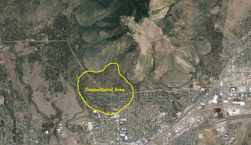
There may have been a trigger that started the landslide besides just the steep gradient of the laccolith. The photo below shows the escarpment left behind after the landslide occurred.

At the apex of the escarpment is a rock formation known as Devil's Throne. This rock and several smaller extrusions were pushed up along a linear fracture in the laccolith just above the top edge of the Moenkopi sandstone slab. Their placement and enlargement may have provided the push that sent the side of the mountain down. Not to worry though, all this happened a few hundred thousand years ago.
No comments:
Post a Comment